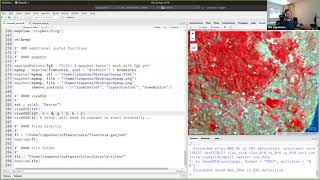
tim appelhans: "using mapview and mapedit to visualise and edit geo-spatial data interactively in r"
Published 5 years ago • 2.9K plays • Length 1:21:25Download video MP4
Download video MP3
Similar videos
-
 32:46
32:46
tim appelhans: "introduction to mapview and mapedit"
-
 33:54
33:54
tim appelhans - mapview package tutorial (part 2)
-
 1:56:17
tim appelhans - mapview package tutorial
-
 7:18
7:18
profile: tim appelhans (gfk geomarketing, germany)
-
 1:39:37
tom hengl - step-by-step tutorial to optimization of geocomputing (tiling & parallelization) with r"
-
 6:16
6:16
barton (appellant) v wright hassall llp (respondent)
-
 6:51
6:51
research to reality: cambridge mobile telematics
-
 15:50
15:50
mindfulness at tibet's secret temple exhibition, wellcome collection
-
 58:46
58:46
robin lovelace: "geocomputation with r"
-
 1:02:02
plenary: madlene nussbaum, tim appelhans
-
 56:04
56:04
edzer pebesma: "scalable raster data analysis in the cloud with r"
-
 38:45
38:45
peter strobl: analysis ready data
-
 1:07:25
edzer pebesma: "simple features for r / tidy spatial analysis" practicals
-
 43:07
43:07
jannes münchow: "r-gis bridges: the examples of rqgis and rsaga"
-
 26:27
26:27
geomputation with r book
-
 1:33
1:33
app.earthmonitor.org: listing and exploring geostories from hub tab
-
 1:23:30
yu-feng ho (opengeohub): modern geospatial data management
-
 11:24
11:24
marius appel: processing large satellite image collections as data cubes with the gdalcubes
-
 0:40
0:40
expert insight - andreas huhmer - all the tools to advance proteomics
-
 1:55
1:55
open-earth-monitor hackaton 2023 call for participation
-
 0:31
0:31
allen mouse brain connectivity atlas & brainspan atlas of the developing human brain